

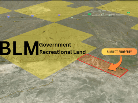

46.66 Acres of Pure Nevada Freedom Your Private High Desert Escape
Contact us now!
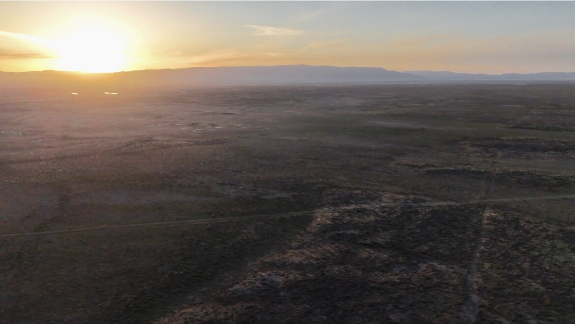
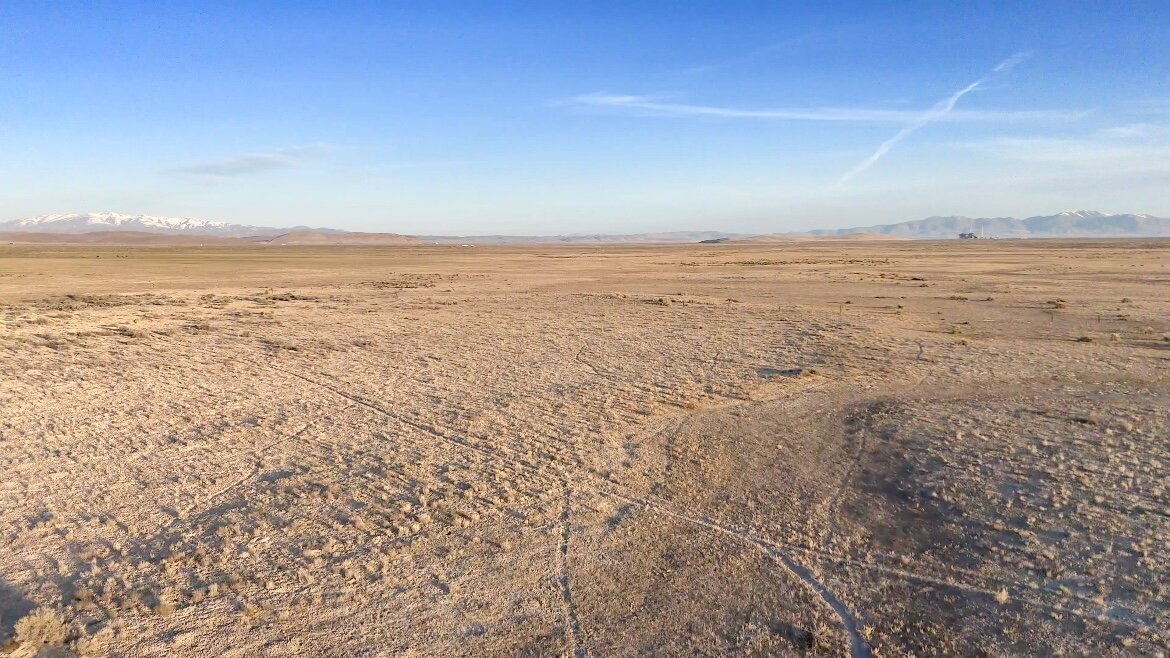
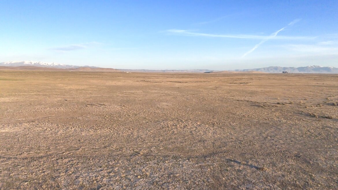
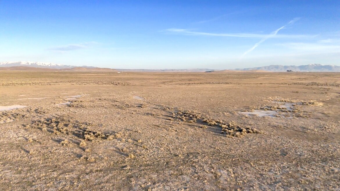
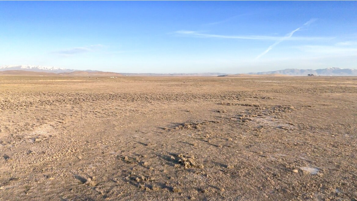
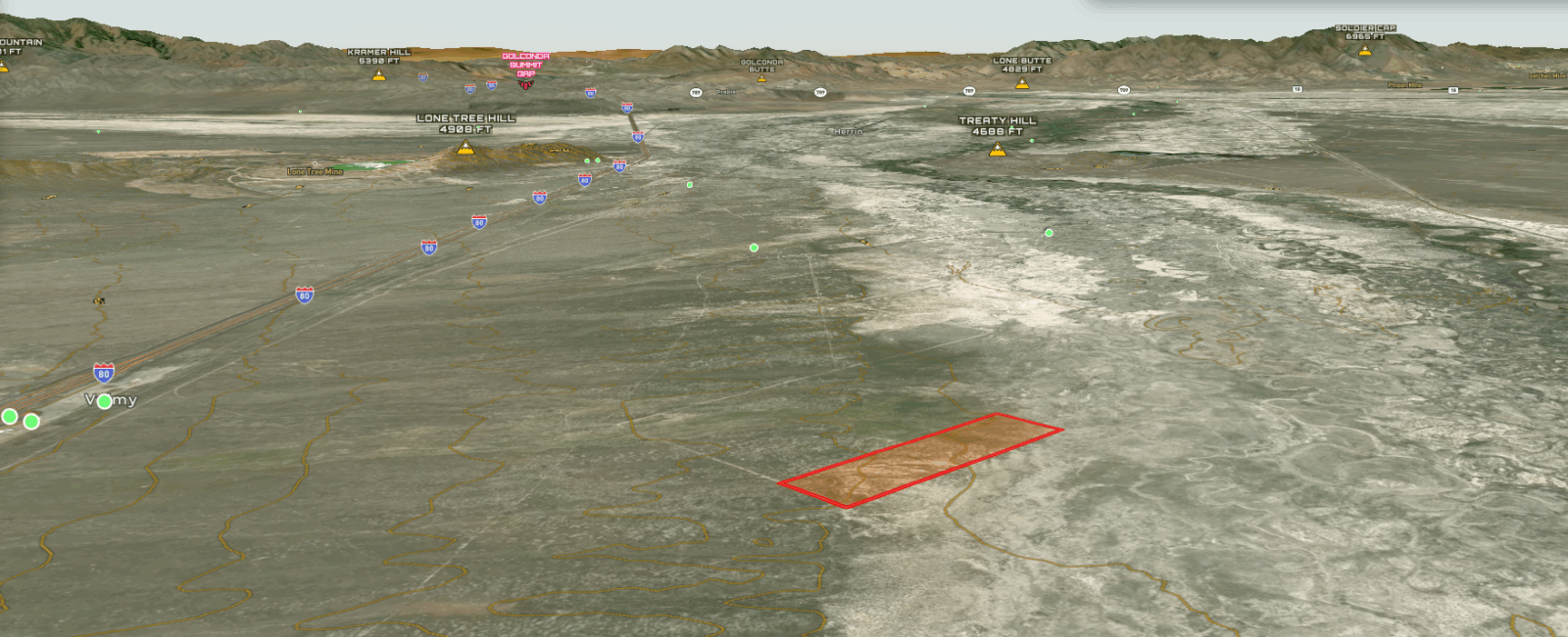
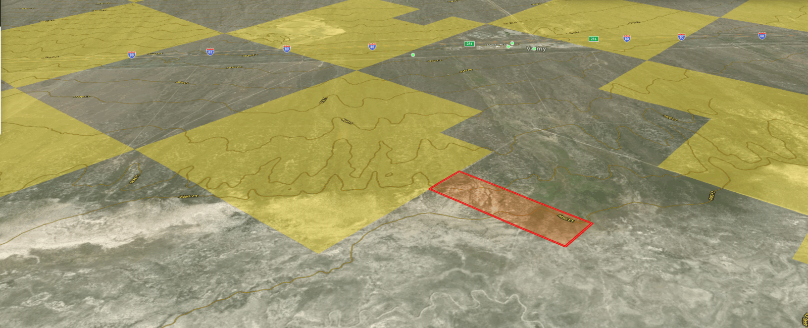
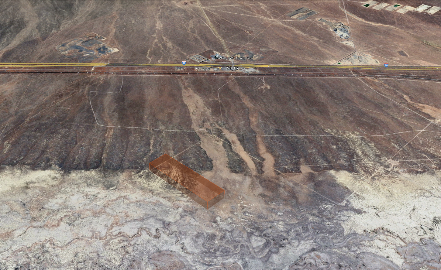
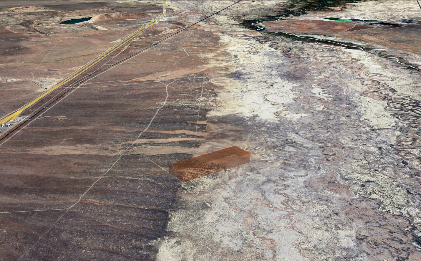
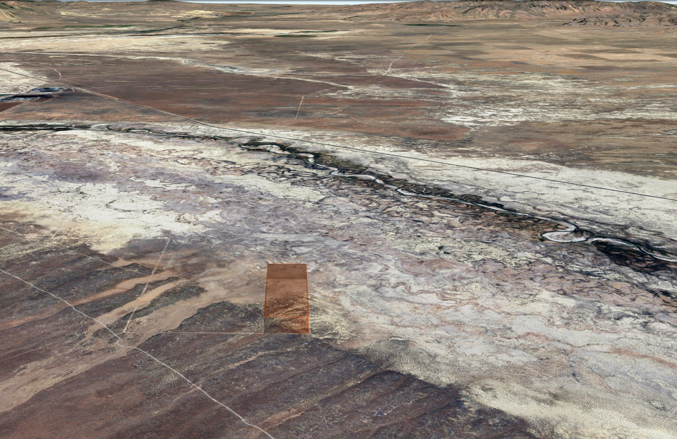
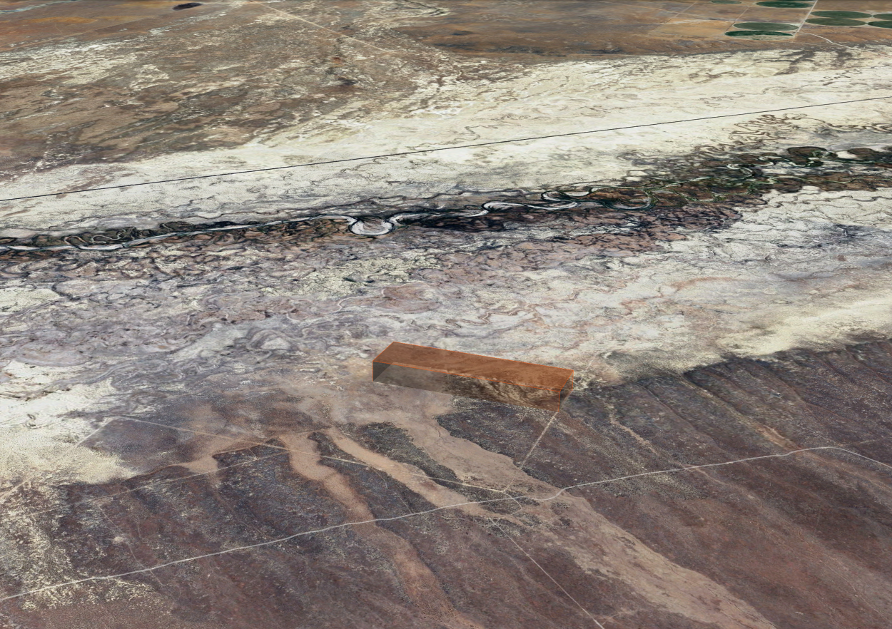
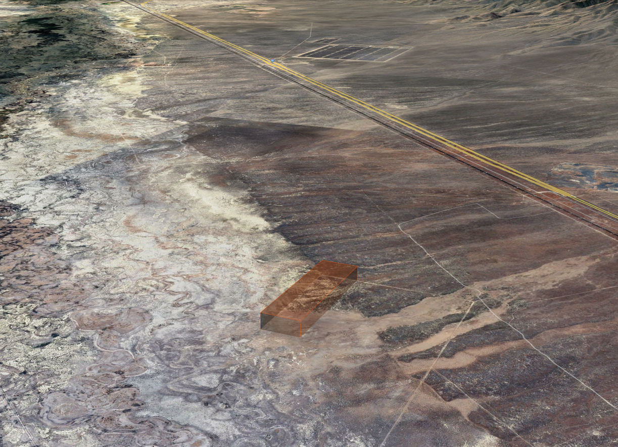
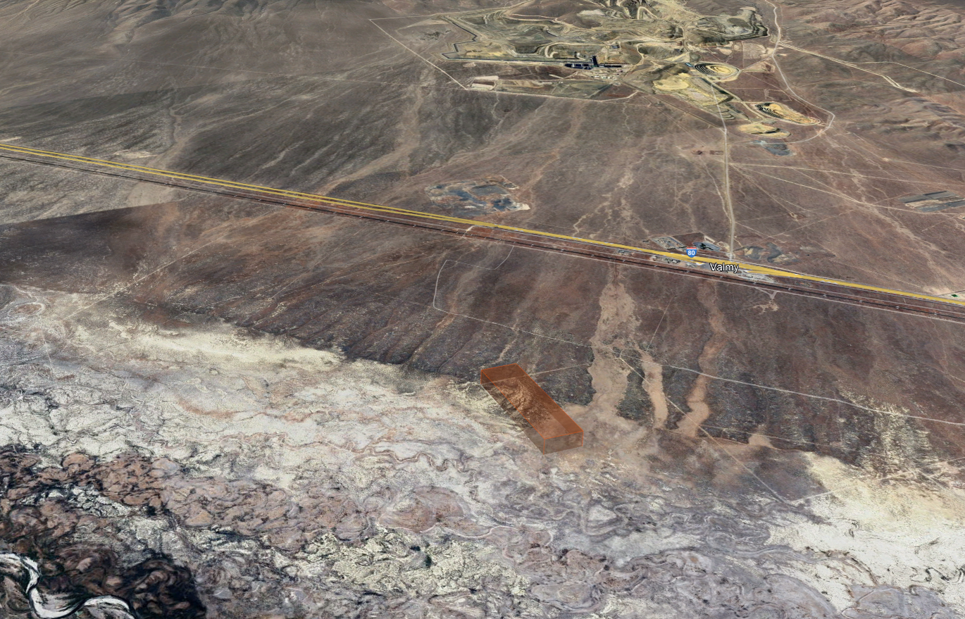
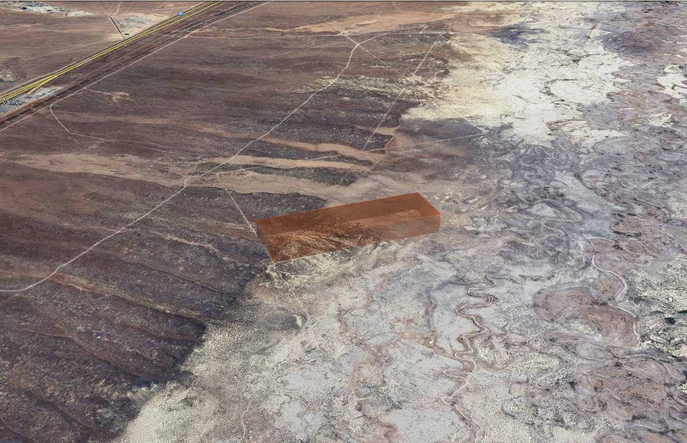
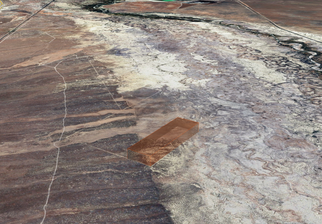
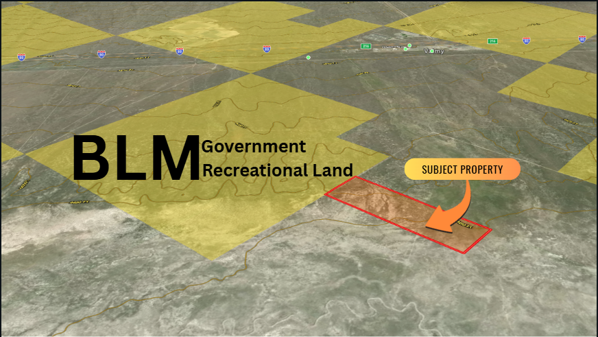
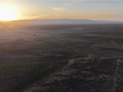
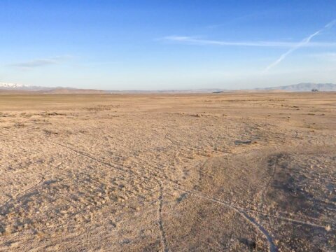
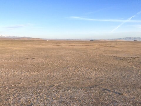
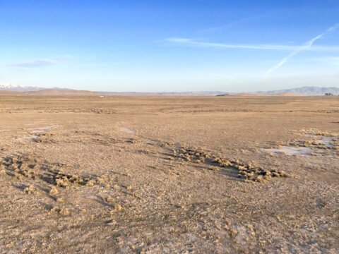
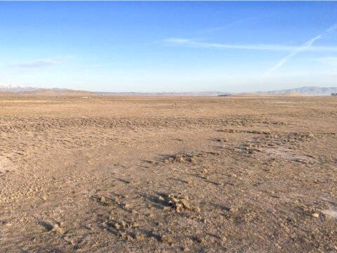
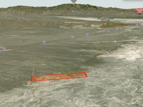
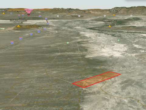
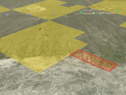
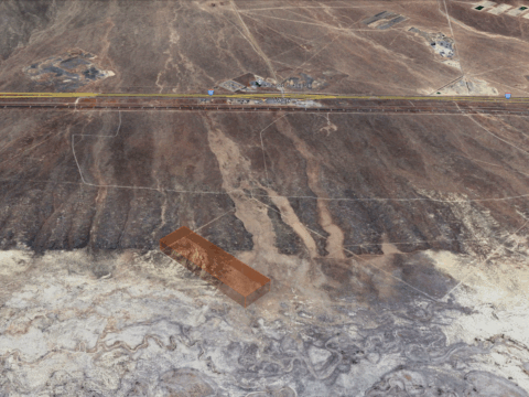
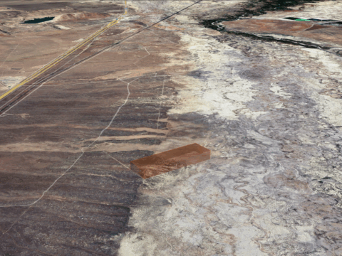
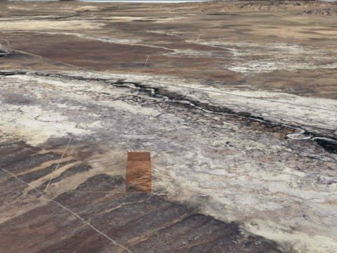
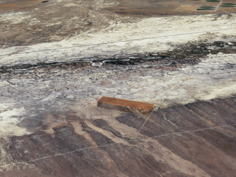
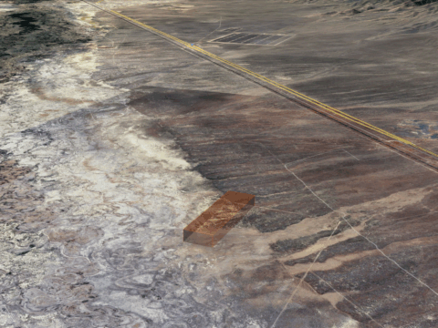
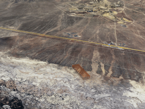
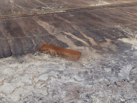
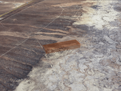
Escape the noise and discover genuine Nevada freedom on this vast 46.66-acre property in the peaceful high desert of Humboldt County. Surrounded by open landscapes and endless horizons, this land offers the perfect blend of tranquility, natural beauty, and opportunity.
Whether you dream of building an off-grid homestead, creating a private weekend getaway, or securing a smart long-term investment, this versatile property makes it possible. Featuring gently rolling terrain and breathtaking mountain vistas, it’s an ideal location for camping, RV living, or enjoying outdoor activities like hiking, hunting, and stargazing beneath the wide desert sky.
Pricing:
Discounted Cash Price: $11,997, Or;
Owner Financing Available: $599 down, then just $449/month for 72 months
- No credit check!
- No income verification!
- Everyone qualifies!
- No Realtors fees
Looking to Save Big with Owner Financing?
Put more down upfront or commit to a higher monthly payment from the start, and well give you a special deal that saves you thousands over the life of your owner-financed agreement!
To ask questions or to reserve the property, submit an inquiry NOW!
Property Details:
Assessor’s Parcel Number (APN): 07-0405-07
County: Humboldt
Annual Property Taxes: $49.09
Legal Description: Lot 7 of Division into Large Parcels for L Bar Nevada LLC, lying within Section 23, Township 34 North, Range 43 East, M.D.B.&M., recorded in the office of the Humboldt County Recorder on December 5, 2007, under File #2007-11801, Humboldt County, Nevada.
Terrain Type: Desert, Brush
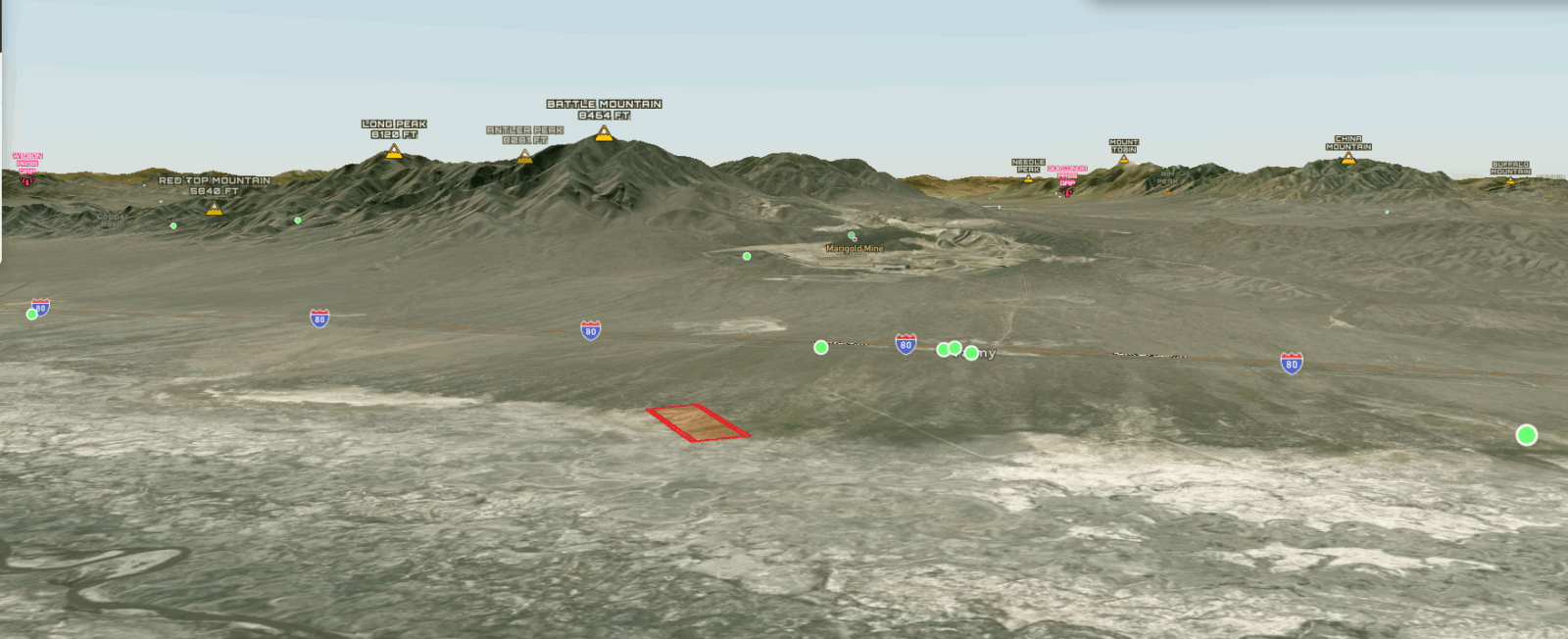
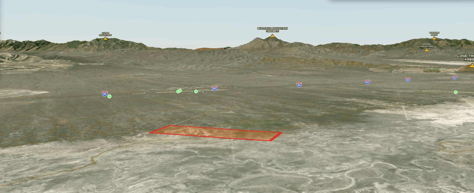
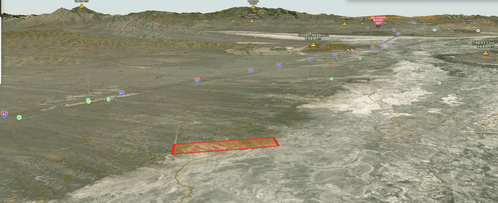
Views From Property: Desert landscape horizon mountains
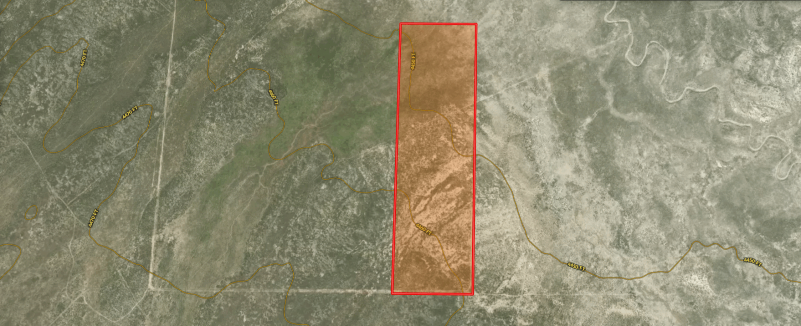
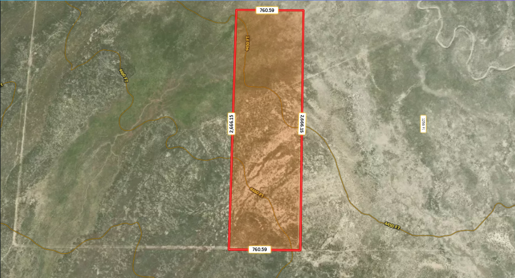
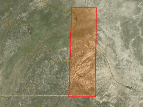
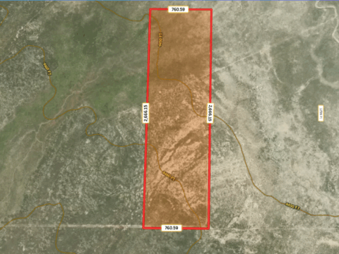
Lot Dimensions:
* 760.59 ft N
* 760.59 ft S
* 2,666.15 ft E
* 2,666.15 ft W
GPS Coordinates (Center): 40.80405, -117.10463
GPS Coordinates (4 Corners):
* 40.8077, -117.106
* 40.8077, -117.1036
* 40.8004, -117.1033
* 40.8004, -117.1061
GPS Coordinate Instructions: Paste one set of coordinates at a time into Google Maps for precise property location & directions. Need assistance? Feel free to reach out we’re here to help!
Questions? Submit an inquiry!
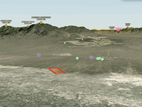
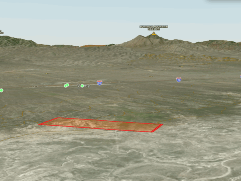
Location, location, location!
Closest Highway: US-191 / I-40
Closest Major City:Albuquerque, New Mexico, 2 hr 58 min (181 miles)
Closest Small Town: St Johns, Arizona, 26 min (25.8 miles)
Closest Gas Station: Speedway, I-40 Exit 339 339, 339 US-191, Sanders, AZ 86512, 26 min (27.4 miles)
Nearby Attractions:
Petrified Forest National Park, Arizona, 50 min (55.8 miles)
Painted Desert Inn, 1 Park Rd, Petrified Forest National Park, AZ 86028, 1 hr 4 min (57.8 miles)
Rainbow Forest Museum and Visitor Center, 6618 Petrified Forest Rd, Holbrook, AZ 86025, 1 hr 32 min (75.5 miles)
Crystal Forest, Petrified Forest National Park, AZ 86028, 1 hr 35 min (77.4 miles)
Zoning & Use Information (Deemed reliable, but not guaranteed. Buyer to verify with County):
Zoning/Property Use Code: Agriculture General (AG)
What can be built (per county): Single Family Dwelling, Mobile Home, etc. See details attached.
Time to build (after a permit is issued): Permits are good for 1 year and may be renewed.
Camping Allowed: Yes
Camping Restrictions: Must dispose of waste & trash properly.
RVs Allowed: Yes
RV Restrictions: Must install septic if long term & dispose of waste & trash properly.
Mobile Homes Allowed: Yes
Mobile Home Restrictions: Cannot be older than 15 years and you will need a permit.
Tiny Homes Allowed: Per county, as small as 200 sq. ft.
Short Term Vacation Rentals Allowed: Yes
Utility Details:
Water: Would require a well or alternative.
Sewer/Septic: Would require a septic system.
Electric: Would require alternative power (solar, generator, etc.)
Gas: Would require propane, contact AmeriGas Propane 928-337-4760, etc.
Waste: Would require a private hauler or visit County transfer stations.
Utility Notes:
Utilities may be difficult to obtain due to access and location.
No visible power poles in the area, alternative power most likely required.